Blog > Discovery of Samoëns in summer > The 10 most beautiful hikes from Samoëns
Historic route and accessible to all, this walk on the outskirts of Samoëns will lead you to the old dikes of Giffre. The undergrowth trails and marked paths will take you through the history of Samoëns, from its stone fountain dating from 1873 to the chapel founded in 1636. Lasting 1h30 and without too much height difference (17m), you will take the departure located on the parking lot of the gondola of the Grand Massif Express in Samoëns to head along the Giffre to the bridge spanning the Clévieu. The route without particular difficulty is accessible all year round for the whole family.
Departure: The car park of the Grand Massif Express gondola
Duration: 1 hours 30
Height difference: 17 meters
Difficulty: very easy
Marking: yes
Terrain Nature: Roads and Trails

Departure: Le Col de Joux Plane
Climb time: 45 minutes
Descent time: 30 minutes
Height difference: 79 meters
Difficulty: Easy
Marking: yes
Nature of the terrain: alpine trails
On the alpine paths from the Col de Joux Plane, the route of this easy hike leads you on a wide plateau with an exceptional panorama. Arrived at the Bourgeois, you can contemplate the Mont-Blanc massif and the snowy peaks of Haut-Giffre after a walk of 45 minutes in the pastures. The summit, marked by the cross of Mapellet and the orientation table, also has a free flight area for paragliders very frequented during favourable wind conditions. The descent takes place on the same route or by descending to the left by a gravel road. All you have to do is drive to the parking lot by road..
This tour, starting from the village of Bérouze, offers a breathtaking view of the valley through the villages of Samoëns, Verchaix and Morillon. The leisure base of the Lacs aux Dames allows you, moreover, to give yourself a little moment of relaxation at the end of the walk to rest your feet in the grass at the edge of the water. Lasting 3.30 hours, it takes many historic paths lined with chapels and oratories, including that of the blind sculptor François-Marie Girod dating from 1826. Between roads and good paths, the marked route, practicable all year round, remains a must to visit the local heritage.
Departure: Place du Bérouze
Duration: 3 hours 30
Height difference: 110 meters
Difficulty: Easy
Marking: yes
Nature of the terrain: roads and good trails
Departure: Place du Gros Tilleul in Samoëns
Duration: 3 hours 20
Height difference: 538 metres
Difficulty: quite easy
Marking: yes
Terrain Nature: Gravel Roads and Forest Trails
Between stacked paths and forest paths, the route taken offers a 3h20 hike through the village of Chantemerle and the Suets forest. The discovery of this village, once inhabited year-round, is also possible with a heritage guide for a visit lasting about 2 hours. You can observe many farm buildings and the chapel dating from 1684 dedicated to Saint Francis de Sales. The sculpted stone windows, true testimony of the presence in Samoëns of Kegnes and Frahans (masons and stonemasons), will bring a historical dimension to this hike. At the starting point, located on the outskirts of the Church of Our Lady of the Assumption, you will notice the big lime tree surrounded by its margelle and a mass of flowers. This tree planted in 1438 is the symbol of the civic life of Samoens and its most privileged witness since the 15th century.

Located at 1763 metres above sea level, on the heights of Samoëns in the middle of the Bostan mountain pasture, this warm and friendly refuge offers accommodation and food. This 3 hour and 15 minute hike, which starts from the Plan aux Arches car park, 800 metres after the village of Allamands, will take you between the lapiaz on the Bostan valley, overlooked by the Dents d’Oddaz. The itinerary, which is fairly easy and signposted, continues through the mountain pastures to reach the refuge, the high point of this itinerary.
Departure : Le Plan aux Arches
Time to climb: 2 hours
Descent time: 1 hour 15 minutes
Difference in altitude: 673 metres
Difficulty : quite easy
Marking : yes
Nature of the terrain: gravel path
Departure : Folly refuge
Climbing time: 3 hours 30 minutes
Descent time: 2 hours 30 minutes
Difference in altitude: 956 metres
Difficulty: difficult (depending on snow conditions)
Signs: yes until the Col des Chambre – GR de Pays le Tour des Dents Blanches
Nature of the terrain: scree and névés
Accessible from the Folly refuge, this difficult hike requires certain equipment depending on the snow conditions (ice axes and crampons) and takes you to the Pointe de Bellegarde. In an alpine atmosphere and dominating the glacial basin of La Vogealle, the ascent offers a remarkable panorama of the Fer à Cheval cirque by way of long scree slopes and névés that can be dangerous in bad weather. Caution and knowledge of the mountain are required for an itinerary that will delight the most athletic.
Accessible from the exit of the village of Salvagny or the hamlet of Fardelay, the refuge is in the heart of the Fonts mountain pasture. Bordered by black schist cliffs, it remains austere but is nonetheless a site that is both rugged, beautiful and attractive. The first access of this itinerary, from the Fardelay, the most accessible, offers you both a forest path and a carriage road for a round trip of about 2 hours. The second, longer and more uneven, will take you on the carriage road from the village of Salvagny for a hike of about 3 hours 30 minutes.

Start A: Les Fardelay
Time to climb: 1 hour 15 minutes
Descent time: 45 minutes
Difference in altitude: 328 metres
Difficulty: fairly easy
Marking: yes
Nature of the terrain: forest path and carriage road
Departure B : Salvagny
Time to climb: 2 hours
Descent time: 1 hour 30 minutes
Difference in height: 443 metres
Difficulty: fairly easy
Marking: yes
Nature of the terrain: wide road
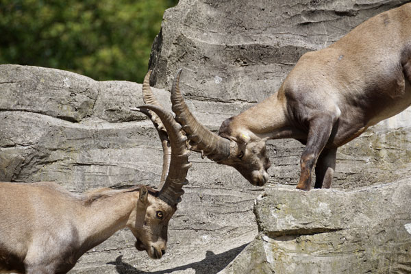
The Pointe de Sales, the first summit of the Fiz range, seems inaccessible at first glance from the valley. However, as it is a real natural setting, you will be able to observe numerous chamois from the mountain pasture paths, scree slopes and lapiaz that you will take. From the Sales refuge, accessible from Sixt Fer à Cheval, the unmarked itinerary climbs under a succession of rocky outcrops before reaching a flat area from which the view of the Sales valley is particularly remarkable. When you reach the top of the Pointe de Sales, you are offered a most exceptional panorama, the Mont Blanc chain and its eternal snow.
Start : Le refuge de Sales
Climbing time: 2 hours
Descent time: 1 hour 30 minutes
Difference in altitude: 627 metres
Difficulty : quite difficult
Marking: no – paths and cairns
Nature of the terrain: alpine paths, scree and lapiaz
Departure A : The Anterne refuge (Alfred Wills)
Climbing time: 1h20 to the lake, 2h to the pass
Descent time : 1h05 from the lake, 1h25 from the pass
Difference in altitude: 447 metres
Difficulty: fairly easy
Marking: yes – GR5
Type of terrain: very good alpine path
Departure B: To reach the Anterne refuge: Le Lignon
Climbing time: 2 hours 15 minutes.
Descent time: 1 hour 30 minutes
Difference in altitude: 630 metres
Difficulty: fairly easy
Marking: yes – GR 5
Nature of the terrain: forest paths and mountain pasture trails
On a mountain pasture path, this hike, one of the most famous in the valley but also one of the most beautiful, will lead you at an altitude of more than 2100 meters to the lake of Anterne. The itinerary can be done in one day with a departure from the Lignon via the Rouget waterfall but this hike can also be done in two days with a night at the Wills refuge to be more accessible to everyone. After the refuge, the path, initially rather steep, flattens out between the lake of Anterne and the small pass of the same name to let you contemplate the formidable panorama offered to you on the cirque of the Fonts.

Start : Le Cirque du Fer à Cheval
Time to climb: 1 hour 45 minutes
Descent time: 1 hour 50 minutes
Difference in altitude: 435 metres
Difficulty : quite difficult
Marking: yes
Type of terrain: alpine and rocky paths
Remarkable viewpoint facing the summits of Tenneverge and the Ruan massif, the chalets of Boret and the Bout du Monde are accessible after a rather difficult hike, including aerial passages, equipped with cables, delicate and even impassable in case of rain. From the Cirque du Fer à Cheval car park, the itinerary follows mountain pasture paths, rocky paths and crosses several torrents to reach the end of the glacial combe, the end of the world. The quietness of the place and its magnificence offer a spectacular view of the Giffre valley and the surrounding summits. Note that the End of the World is easily accessible if you do not go through the Pas du Boret!
To find out more about all the walks around Samoëns, go to the Haut Giffre Valley website. You can download the hiking guide for the Giffre valley.
A big thank you to Patrice Gain, environmental engineer and mountain professional, for his time and good advice for your future hikes!
